January 17, 2023
This morning, I have been planning our route from Green Turtle Cay to Marsh Harbor. As I’ve mentioned (at length, I know), sandbars block the route south through the Sea of Abaco, so all but the shallowest vessels have to pass into the Atlantic via Whale Cay Channel, go around Whale Cay, and then reenter the Sea of Abaco through Loggerhead Channel, passing just inside Great Guana Cay.
The routes are all marked on the charts; it’s just a matter of entering the Waypoints into the chart plotter, and then connecting them to build a route. It looks like the entire outbound and inbound passage will take less than an hour.
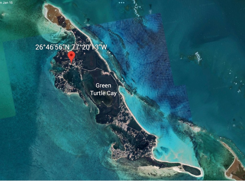
As I was (once again) looking at our position on the charts, it occurred to me that many of you might have trouble envisioning exactly where we are. Try this: Open Google Earth and search for Green Turtle Club. Drop a location pin on it, so that you can expand the map area without losing it. See screen shot above.
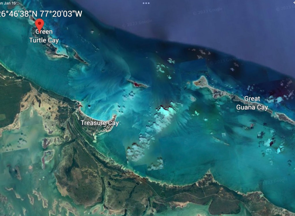
Expand the map a bit to include the islands just to the right of Green Turtle Cay. Now the landscape becomes clear, doesn’t it? You can actually see the sandbars that block our southbound passage. You can see the cays – Green Turtle, Whale and Great Guana, that we are talking about. These are three of the barrier islands or cays (pronounced “keys”) that separate the Atlantic Ocean from the Sea of Abaco. (above)
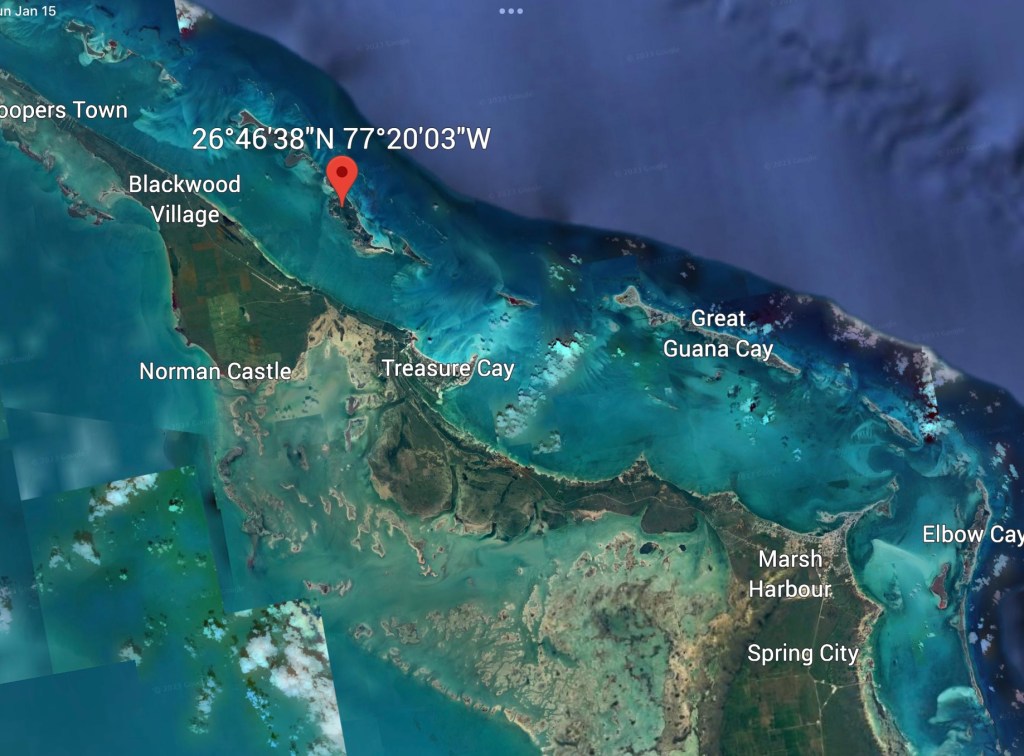
To the east of these cays – toward the open Atlantic, you can sense where the line of reefs lie. And beyond the reefs, you can see the change in water color where the ocean floor plunges into the abyss. (Marsh Harbour near the bottom is where we are headed next.)
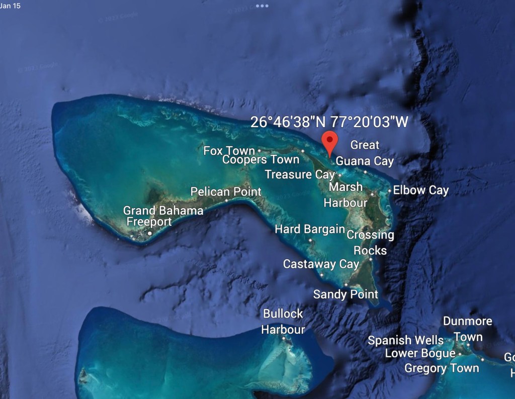
Now expand the map to see the entire Bahamas chain. Green Turtle already seems small, doesn’t it?
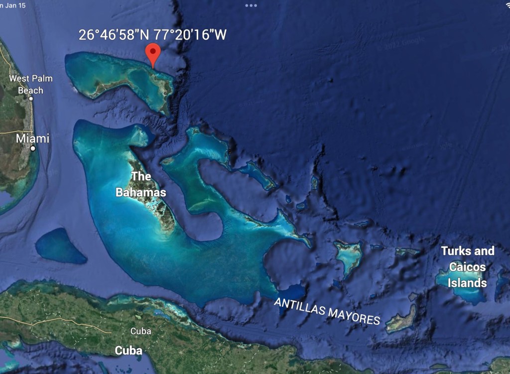
Now back out still farther to include the coast of Florida and Cuba, and you begin to understand what I mean when I say it is “just a drop in the ocean.

The pics are really helpful. Makes you wonder how they did it back in the day without google earth.
LikeLike