It’s now October 17…less than a month before we leave, and my prep time feels like is getting very compressed.
I’ve planned every stop on the route down, and I’ve confirmed reservations wherever possible.
I’ve reserved a slip for a month in Key West – arriving 12/4/20 and leaving 1/4/21
I’ve stocked the boat with a new TV and DVD player, new anchor line and life jackets, and backup parts for all the critical systems.
On Wednesday of this past week, I went over the boat from stem to stern with one of the Haven Harbour mechanics, seeking to ensure that Freedom is ready for an extended trip.
I’m sure we’re in for many unexpected surprises, but we’ve prepared the best we can…
That’s the end of today’s post. I have lots more to share, but I have too much else to do for now. Stay tuned.
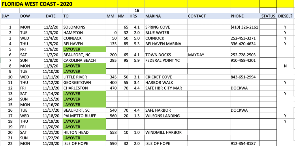
Pilots file Flight Plans. Sailors file Float Plans. Here’s the first segment of ours, built in Excel.
Here’s how we built it:
It begins in early November, because our insurance policy will not allow us to be south of Cape Hatteras until the hurricane season ends on November. 1st.
We began planning each day’s leg by looking ahead 50-80 miles to see what marinas were available.
Sometimes the legs were shorter; sometimes longer.
Then we built in our layover days: at least one per week, allowing for weather.
More layover days for fun stops like Charleston
MM stands for Mile Marker. The ICW portion begins at MM 0 in Portsmouth (Hampton), VA and ends at MM 1245 in Key West.
NM stands for Nautical Miles traveled that day. This is the critical variable for planning purposes.
HRS stands for Running Time in hours at an average of 16 knots.
Based on the Float Plan, I expect the trip to take 33 days elapsed time, allowing for layover days for weather and R&R. We’ll leave 11/2 and arrive in Key West December 4th.
It’s 26 actual travel days. Not particularly daunting… just 26 days when – every day – something can possibly go wrong. Ha Ha.
Each horizontal row represents a single day-trip. Green cells are lay-by days for visiting or for rest or as a bad-weather provision. There are also yellow cells indicate opportunities to leave the ICW and travel “outside” for a speedier passage. These opportunities exist because there are inlets that are safe to navigate (many are not), but the decision to go outside is entirely weather-dependent.
For that matter, the entire schedule is entirely weather-dependent. We will take whatever steps are prudent to avoid bad weather. Rain isn’t a problem, but rough sea conditions may cause delays, particularly in places like Albemarle Sound. The Sound is only 14 miles across (less than an hour for Freedom), but it can become very choppy because it is uniformly shallow, and wind from almost any quarter can create rough, confused seas. (per Waterway Guide). In particular, if the wind is as little as 15 knots out of the west, it can make for a very unpleasant crossing. For that reason, it may be necessary to lay over an extra day or two in Coinjock to wait for better weather. We may even have to wait up in Hampton if the boats ahead of us are holding up in Coinjock. If the marinas are full, we need them to move out so that we can move in.
In that case, the entire schedule may slide. We built the same flexibility into our plans when we brought the boat down from Nantucket: Hurricane Isaias was threatening the Northeast, so we just holed up in a protected marina and let it pass. We were able to make up the lost day by skipping one scheduled stop. Something similar will undoubtedly happen on this trip.
It is critically important to make decisions according to the weather, not the calendar. It doesn’t really matter when we arrive at each intermediate stop. Reservations can usually be tweaked with no problem, or an alternative can be found. Safety and comfort come first.
Forget what I said in my last post about not trying to do day-to-day planning in advance!
Once I broke the trip into segments, it seemed much more manageable to then break those segments down into day trips. I’m sure there are folks who would set out on this trip with a minimum of pre-planning. That’s not me; I’ve always been a planner.
I’d like to get a sense of how long this trip will take, so I have to figure out how far I’ll travel each day and where I will stay each night, so that I can set up marina reservations. But one of the biggest unknowns I’m grappling with is how many miles I should plan on traveling each day. I know how fast Freedom can go, but I don’t really know what the ICW is like: is it like Interstate 95? or more like a wandering lane? I hear it’s a little bit of both.
Anyway, here’s my thought process:
Freedom has enough fuel to travel more than 200 miles per day, but that’s neither safe nor comfortable:
That would run her fuel down to ZERO – very foolhardy. In fact, it’s better (more prudent) to always “run off the top half of the tank”. So that limits us to a maximum of 100 miles per day for planning purposes.
Also, Freedom’s most efficient cruise speed is around 18 mph. At that speed, it would take almost 13 hours to cover 200 miles… exhausting when you are single-handling.
In addition, there will be slower boats ahead of us all the way. We will pass them, but to do so courteously, we have to slow down. There are also multiple “No Wake” zones, and that reduces your average speed.
For all these reasons, and based on advice we’ve received from experienced captains, we will plan to travel around 50-80 miles per day average. At an average speed of 16 mph, that’s about 5 hours per day. Perfect.
Now I can get to work roughing out a day-by-day itinerary.
Once I do that, I’ll start to get a time frame for the overall trip.
I’ve spend hundreds of dollars on charts and Waterway Guides: I have a stack of paper that’s probably 7″ high. And I’ve spent A LOT OF TIME reading about the routes we’ll follow. Plus, I get online Alerts that arrive electronically: reports of channels that have shoaled; missing navigational markers; and treacherous inlets. Most of these cautionary notes pertain to sail boats with deep draft. We draw only 4 feet.
We also have to pay attention to bridge clearances. Again, these pertain mainly to sailboats: we can pass under bridges with just 14 feet clearance, as opposed to some sailboats that have 50+ foot masts.
Nevertheless, the amount of information that one has to take in can be daunting. If I were the worrying sort, I might be hesitant about the entire trip. But hundreds of people do it every year, and I think I’m well prepared. Perhaps better prepared than many.
Still, it’s a lot to learn, and a lot to visualize. As a consequence, I’ve decided to break the trip into discrete pieces in order to make it more manageable.
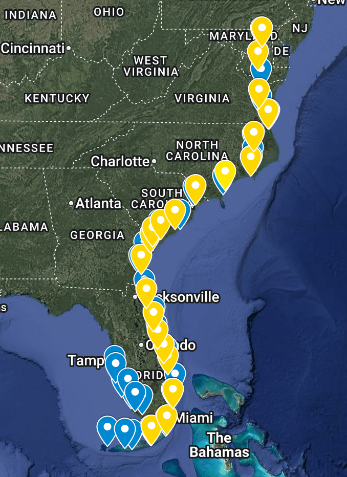
++++++++++++++++++++++++++ The first “chunk” is the section in the Chesapeake Bay: from Rock Hall to Norfolk, VA, at the southernmost tip of the Bay. Once I get to Norfolk / Portsmouth, I’ll be at Mile Marker Zero, the start of the ICW.
The next chunk is a single leg, from Norfolk/Portsmouth, through the Virginia Cut, through the Great Lock, to Coinjock, Virginia. Then a long run of 68 miles across the Albemarle Sound to Bellehaven. Once I get there, I’ll have a lot of experience under my belt. Each night, I’ll carefully plan the next day’s route and check the weather. It’s simply too much to try and plan the entire trip in detail in one sitting. But if I handle it one day-trip at a time I’m confident it will minimize the inevitable exigencies that will arise.
BTW, I’m dictating these thoughts using an app called Speechify. I dictate into Speechify, copy the text into Word Press and edit the final version. So far so good, but please excuse any garbled content!
When I first started posting about my trip plans, Barbara Drennen (a cousin) asked if I had solo sailing experience. I guess the answer is no and yes.
Remember that I grew up on boats, and Cathy and I had boats our whole married life.
So, for the last 50+ years, I wasn’t saying solo; I always had someone with me – Cathy. But, she always trusted me to plan the routes and captain the boat. She was happy to help with other tasks (handling the lines, etc.) but she was happy to let me be the captain.
So for all these years, I have always felt the responsibility of command. Not to over-dramatize it, but to plan the route, make the right decisions, and get us to the next destination safely.
I believe that the MOST IMPORTANT role Cathy played was as observer – we always ensured that our boats had a seat for her right next to mine, because she was constantly on the lookout for other boats or hazards. She was also always there for advice and consultation.
The new boat, however, has increased my confidence that I can go solo: – It has auto-pilot, so that I can set a course and then spend the travel time on the lookout as Cathy used to do – The auto-pilot means driving is much less stressful – Bow and stern thrusters mean I don’t need Cathy’s help to guide Freedom into a slip. – Freedom is a heavy, well-built boat that can handle wind and waves. – And of course it has a chart plotter (GPS), depth sounder and radar.
My only real SOLO experience was bringing Freedom down alone (with Guinness, of course) from Nantucket. It took two weeks. There were several spots where we were out of the sight of land, relying entirely on instruments. We dodged a hurricane simply by holing up in a protected marina, and we became proficient at planning and executing each day’s trip. We got in and out of multiple harbors and multiple docking situations. We also encountered some very sloppy seas on Buzzards Bay, and she handled herself admirably. Not bad weather – we don’t go out in bad weather, but it often blows 25 knots on Buzzard’s Bay.
The Nantucket trip turned out to be the shakedown cruise, and it increased my confidence in the boat and my ability to handle her.
Importantly, I also realized the importance of careful planning; perhaps we’ll talk more about that in our next few posts.
By 7:20 on Thursday, we were fueled and underway. What a morning: sunny and calm! We have been so lucky in that regard on this trip…the winds and currents can be pretty strong on these islands, and it could be a real challenge to single-handle in rough conditions. But it seems like it always calms down when we need it to!
Sea conditions are excellent: 1′-2′ seas, with low humidity. The sun is over the transom as we head due west for Martha’s Vineyard and Wood’s Hole.
Hadley Harbor at 9:35. Dug up some clams and mussels and boiled them in seawater. Had an early lunch and left for Marion at 11:30. We were on our mooring by12:30!
It’s the first time we were traveling for more than an hour outside the sight of land
Visibility was restricted by haze.
Seas were sloppy: 2′-3′ right on the port beam. Extremely uncomfortable.
And on top of everything else, an alarm went off telling us we were critically low on fuel!
Logic told me that we couldn’t be out of fuel, but it was still upsetting. Nothing to do but continue!
We finally made the breakwater at 1;15. Just 2 hours but it seemed a lot longer.
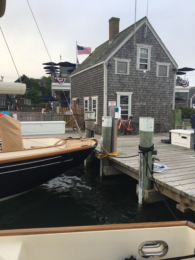
We’re staying at the Nantucket Boat Basin, a huge upscale marina in the heart of the harbor. There are a series of piers built out into the harbor, each large enough to contain cottages, restaurants and shops.
These are fixed docks with a significant tidal range, so the dockhand who helps you into your slip carries an electric drill with which he repositions the metal ladder so that it’s perfect for boarding and reboarding! Snazzy!
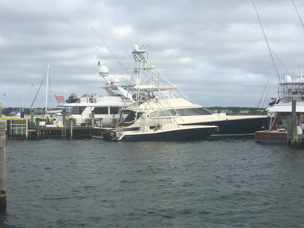
The boats here are huge as well. It’s our first exposure to megayachts; we simply don’t see them on the Chesapeake.
Even the sporsfishermen are huge. This one is a 70-footer with a 35-foot tender. His tender is bigger than my boat!
Today has been kind of quiet: shopping and laundry. It’s a good day for it: 66 degrees and cloudy. I hope it’s prettier tomorrow when we head back to Marion.
Martha’s Vineyard is a large island, with several harbors. We plan to visit two of them: Lake Tashmoo, and Vineyard Haven, on the way to Edgartown, the tourist Mecca!
Both Lake Tashmoo and Vineyard Haven looked pretty, but rather quiet, so we continued on to Edgartown, arriving around 11AM.
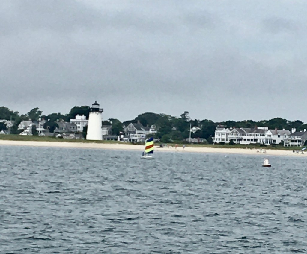
Here we are passing the iconic Edgartown Harbor Light at the harbor entrance.
This is so exciting! I can’t believe I’m here on my own boat. What a birthday present!
Since we plan to stay just a couple of days, we elected to pay an outrageous fee to tie up to a pier, rather than pick up a mooring. Glad we did. It gave us a lot of flexibility.
Spent part of the afternoon dealing with paperwork: the sale of my old boat was being finalized, The broker – Tom Lippincott – had to send some papers to the local notary, and I had to sign them and get the hard copies back to the broker in Rock Hall.
It seems he sold Whistler in 4 minutes. He had no sooner published the photos to Yacht World, than the buyer called! “Is Whistler still available?” I guess so, I just posted it 4 minutes ago!” “Well I want to buy her!” Hah!
Tuesday morning we were up early for a walk to the lighthouse and an early morning swim.
The harbor is foggy. I hope it clears up later…I’m hoping to leave for Nantucket if I get the paperwork done.
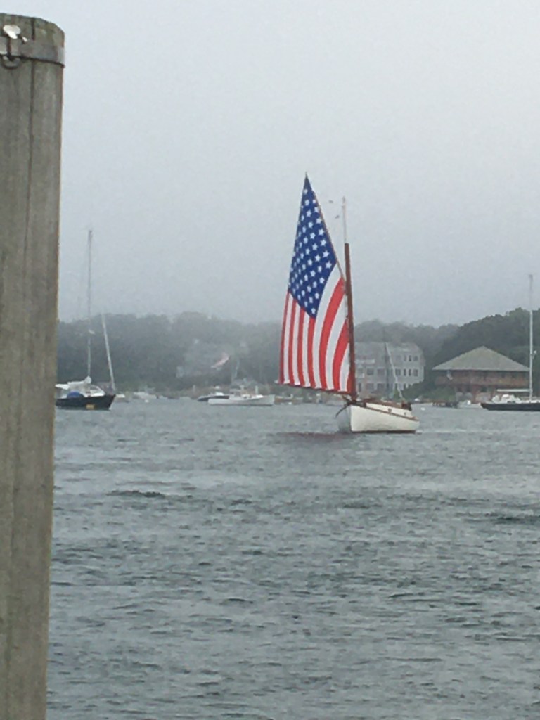
Here’s a great shot of a cat boat emerging from the mist:
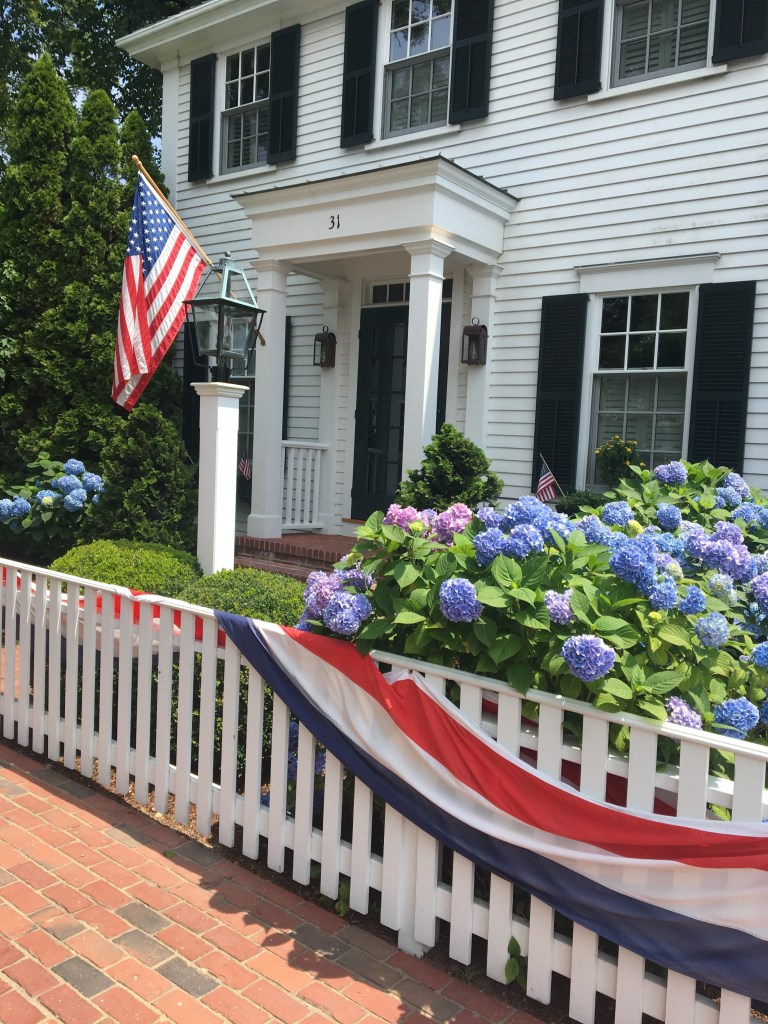
The houses here are also gorgeous!
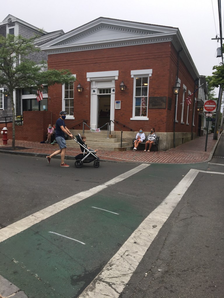
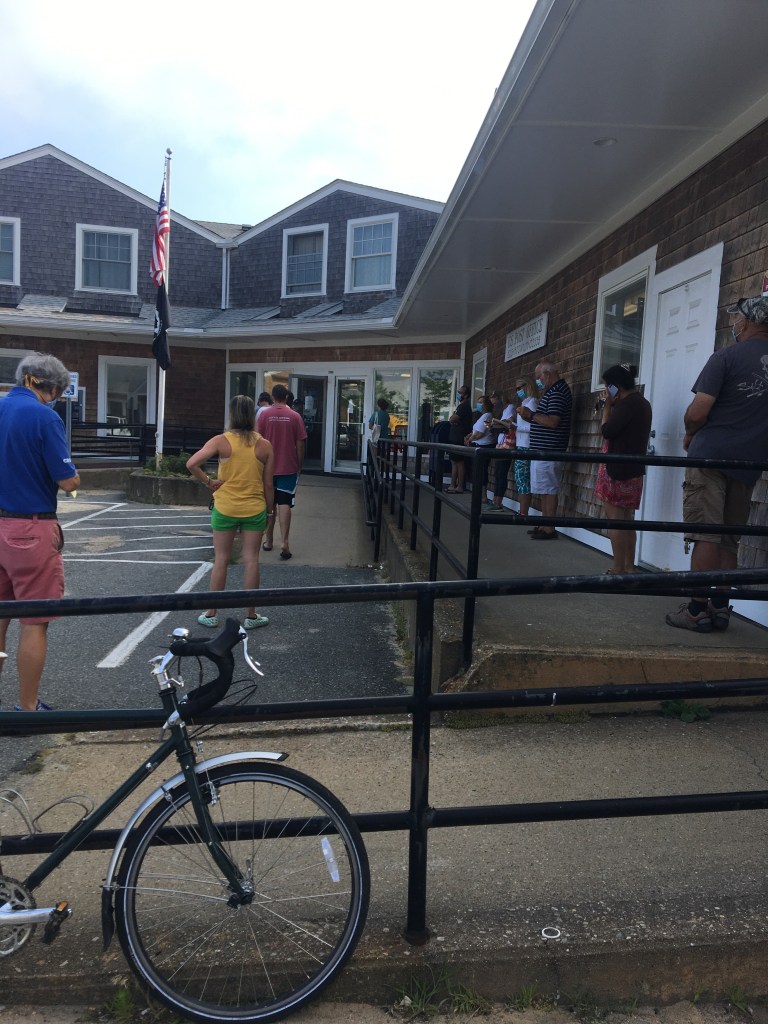
Well, it took just 30 minutes to complete our business at the bank! Unfortunately, it then took 30 minutes to walk to the post office. And then it took 2 hours in line at the post office! Gotta love Covid! Or maybe it’s always like this?
Here’s the cute little bank:
And here’s part of the line at the post office! Everyone masked and 6′ apart!
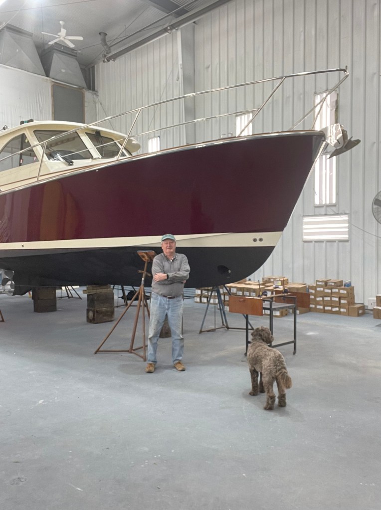
When we first saw Freedom, she was in an indoor storage shed, and she looked huge!
At 16,000 pounds, she has over twice the displacement of my last boat – Whistler – which was a 28′ Legacy. It’s weird: she is just 4′ longer than Whistler, but she has twice the interior space that Whistler has, and she has many more complicated systems that I’ve never had in a boat:
Generator
Inverter
Air Conditioning
Refrigerator
Freezer
Induction cooktop
TV
Fresh-water toilet
Bow and stern thrusters
240 volt power
Radar
The addition of 240-volt power means that this boat has three electrical systems:
12-volt (like your car)
120 volt (like your house)
240 volts to drive the AC
The inverter converts the 240 to 120, and she has 5 batteries to provide the 12 volt
No wonder these boats are so expensive!
To complete Freedom’s purchase, she had to pass a Marine Survey and a Sea Trial. Both took place towards the end of June, and she passed with flying colors. By month-end, the sale was complete, and we made plans to move aboard immediately after the Fourth of July weekend.
Our first task was to clean Freedom from top to bottom, and to ensure that she was properly fitted out with the proper gear. Since she was up in Massachusetts, we rented a truck from U-Haul, loaded it with cleaning supplies, charts, and other gear, and headed north.
Four backbreaking days later, the boat was clean to our satisfaction, and we were ready to set out on a weeklong shakedown cruise.
For our first trip we planned to head across Buzzard’s Bay to Wood’s Hole, the well-known passageway to Martha’s Vineyard. We learned from our cruising guide that there is a popular harbor (Hadley Harbor) just off the Wood’s Hole channel. The trip should take about an hour, Perfect for the first leg of our shakedown cruise.
Saturday we were totally fogged in!
On Sunday, July 12th [MY 76TH BIRTHDAY !!!!] we finally left.
It was blowing 15 knots, with 4-foot seas. Not unusual for Buzzard’s Bay, we’re told, but a tough test for Freedom. Spray crashing across the windshield. Towing a huge wake. We tried towing the dinghy, but it was impossible under these conditions, so w figured out how to use the stern davits to mount the dinghy on the swim platform.
Once in Hadley Harbor, everything was calm and peaceful. Played with the dinghy and the electric outboard. Generator working. Enjoyed some wine and a cigar. What a great birthday!
This is Freedom. A 2008 Legacy 32 that I purchased in July of 2020. She is powered by a single 425 hp turbo-charged Cummins Diesel. Her equipment includes an electronic chart plotter; radar; auto-pilot; and bow and stern thrusters that make her much easier to single-handle.
Guinness and I brought her down from Massachusetts by ourselves – a trip that took about 2 weeks. That’s what gave me the inspiration to undertake our Amazing Adventure.
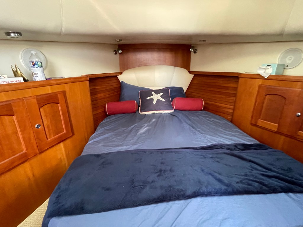
She is wonderfully comfortable inside:
Queen center-line berth in the bow
Beautiful cherry interior
Gorgeous galley
Head with electric toilet and separate shower compartment with glass door and enclosure
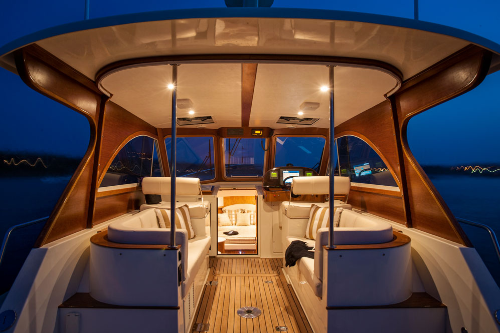
Adjustable seats for the Captain and the Navigator
Two ultra-leather lounges
Air conditioning and heat in the salon and on the bridge deck
Dining table between the lounges and in the aft cockpit
She is a well designed for coastal cruising, and I believe we are going to be VERY comfortable!