Rebuilding the Bahamas

January 30, 2023

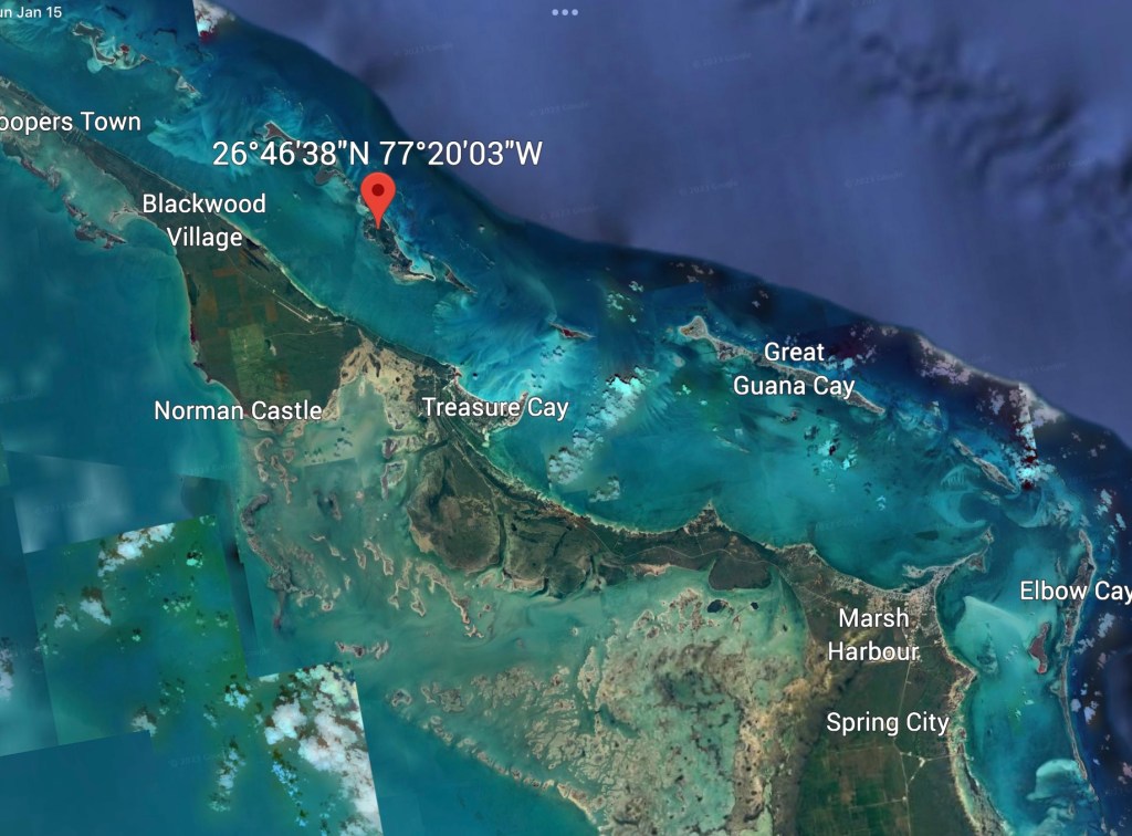
As you know if you follow our blog, we are presently berthed at Marsh Harbor, on Great Abaco Cay.


Marsh Harbor is primarily a working-class town, providing many commercial services (restaurants, grocery stores, medical clinic, nail salon, marine hardware, etc. And several prominent marinas, of which ours is the nicest.


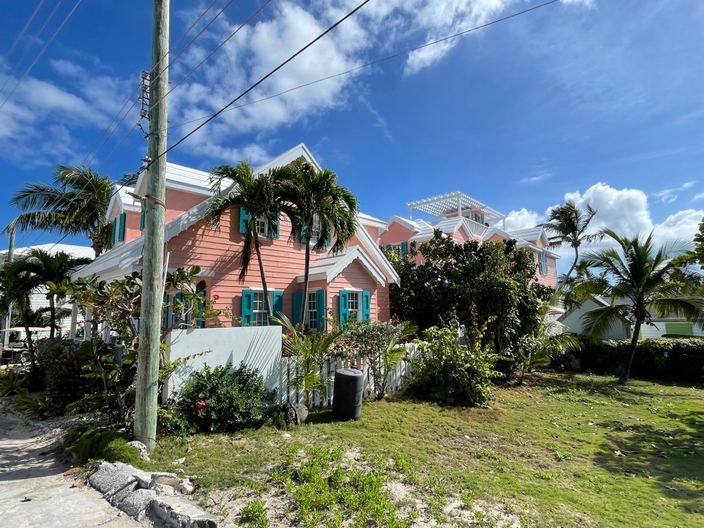
Most of the homes here are modest, owner-occupied. Many built in the 1960’s or even 1950’s. Many of them uninsured. Some have simply been abandoned.


The ”word” on Marsh Harbour is that it has been slow to rebuild. First came the utter destruction from Hurricane Dorian in 2019. Then a year of Covid delayed everything further.


Several days ago, I had an opportunity to speak with our cab driver about his experience. He had just finished building his home in July of 2019. Dorian hit on September 1st. When the roof tiles started lifting off his home, he and his wife took refuge in their car. Cyclonic winds kept repeatedly lifting the car and dropping it, but they survived. Their house did not. They were uninsured.


We mentioned in an earlier post that we had spoken with Michael Albury, of the Albury family from Man O’ War Cay. He’s the one who explained to us, “What do you have to do first in a recovery here? Rebuild the commercial docks. Because without the docks, we can’t get the building supplies we need: wood, cement, etc. It all comes from off-island.”


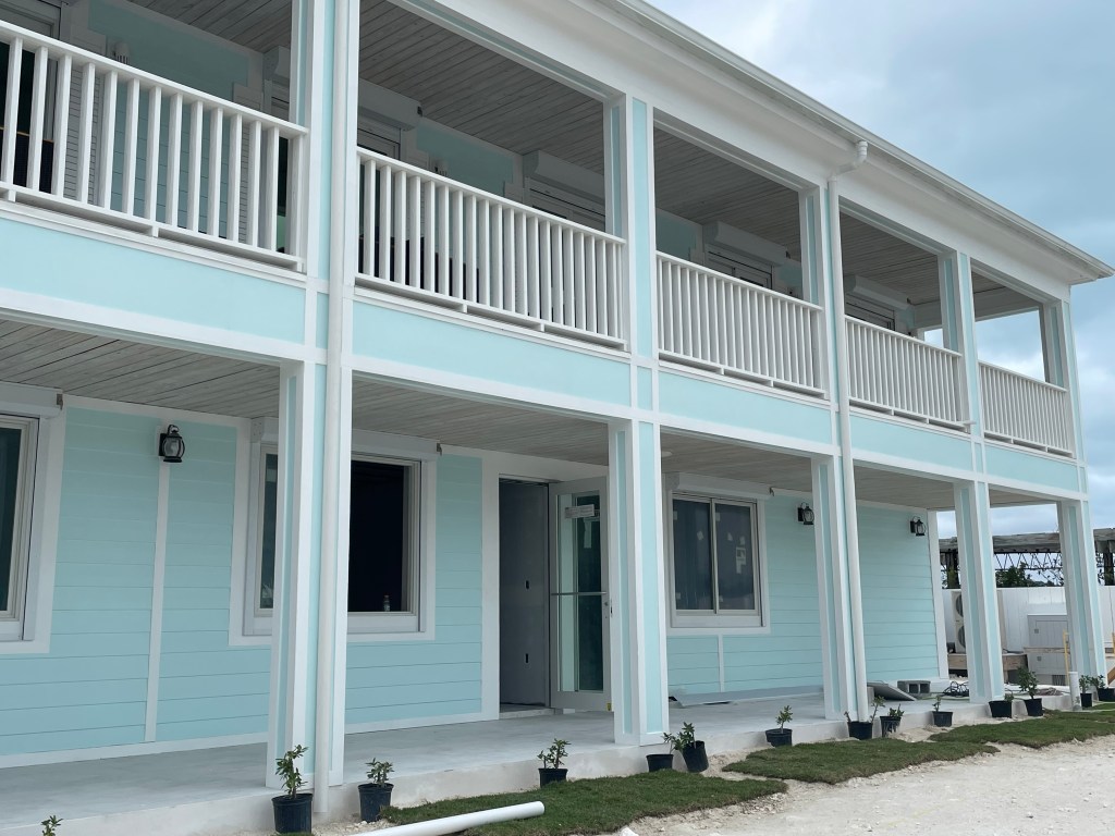
Nevertheless, we have been VERY impressed with the rebuilding that has been accomplished since then in Marsh Harbour. And our marina is certainly gorgeous. Here’s a drone shot…you can see the marina complex on the right and the hotel and the gorgeous beach on the left. The views from the hotel lobby are breathtaking.


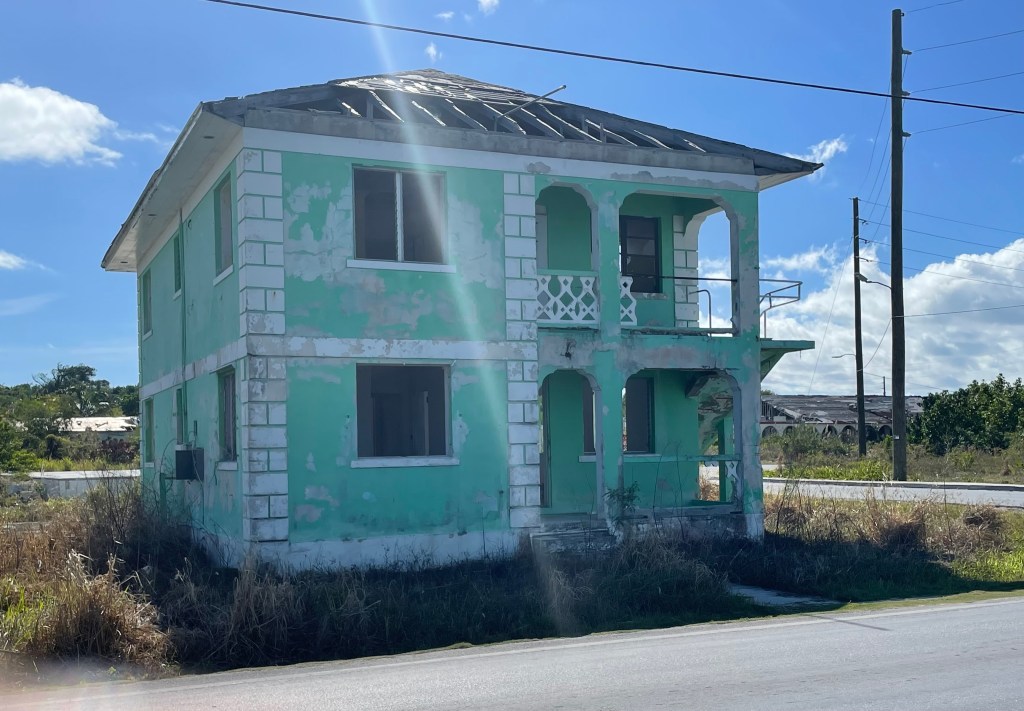
Here’s a “building” right next to our resort


Yesterday, we visited Elbow Cay, where the rebuilding has proceeded at a faster pace than in Marsh Harbour. Elbow Cay is the closest island to Marsh Harbour – just six miles across the Sea of Abaco – a half-hour trip by boat. The island is about six miles long and quite narrow: at some points you can enjoy a view of both the Atlantic Ocean and the Sea of Abaco.


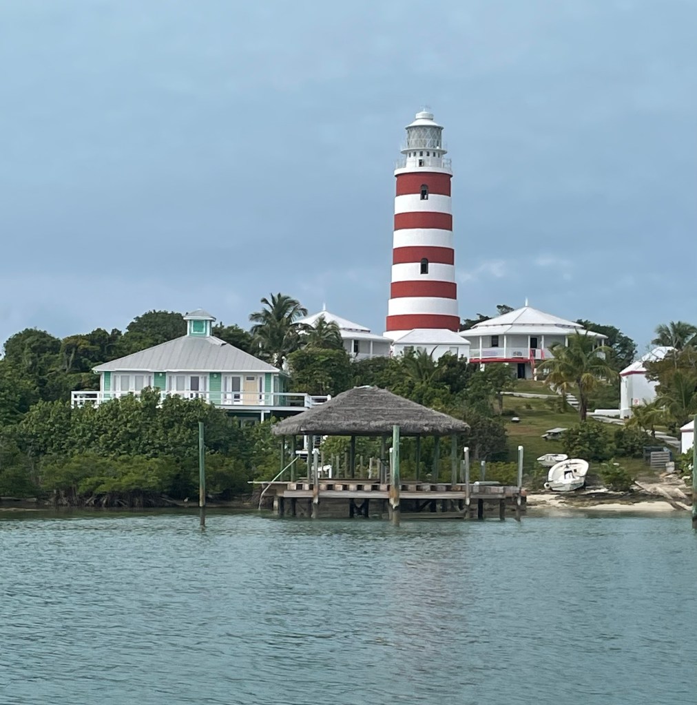
The primary port on Elbow Cay is Hope Town – towards the northern tip. It’s a pretty little harbor, watched over by a picturesque red-and-white-striped lighthouse. This is the only remaining manned lighthouse the Bahamas. It still uses a kerosene light, and the mechanism must be hand-wound daily. The harbor itself is protected on all sides and surrounded by pretty little cottages and houses.


We sailed into the harbor yesterday morning and rented a golf cart for a tour of the island. The farther south we travelled, the more impressive the homes became. Many of these houses are not 100% owner-occupied. They are investment properties, or second homes (or third or fourth). There is a lot more money in Elbow Cay, (and I’ll bet a lot more insurance coverage), and the recovery has been faster.

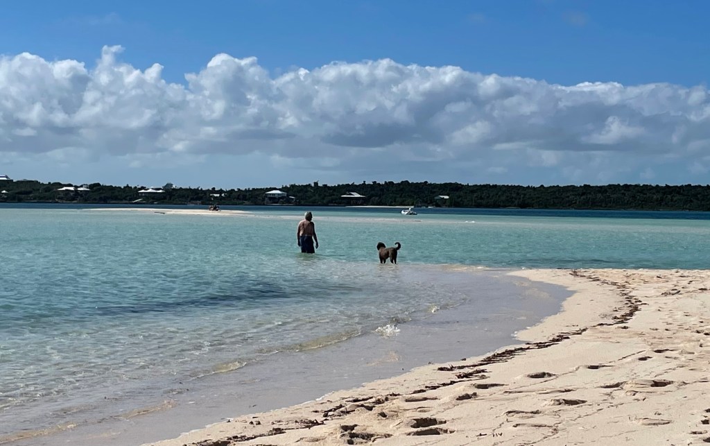
We rode our golf cart all the way to the southern terminus of the island to visit a well-known sandbar called Tahiti Beach. We timed our visit for low tide, because the sandbar extends almost a half mile at low tide.


The sand bar was spectacular, as we expected. What we didn’t expect was the dramatic scenery. The tide began to come in between Elbow Cay and Tilloo Cay – the next Cay south. They are separated by a channel, or “Cut” just a few hundred feet across, and the tips of both islands are defined by rocky promontories.


The tidal current was a visible force of nature, and the waves on the Atlantic side of the cut were crashing into the rocks, showering spray 30’ in the air.

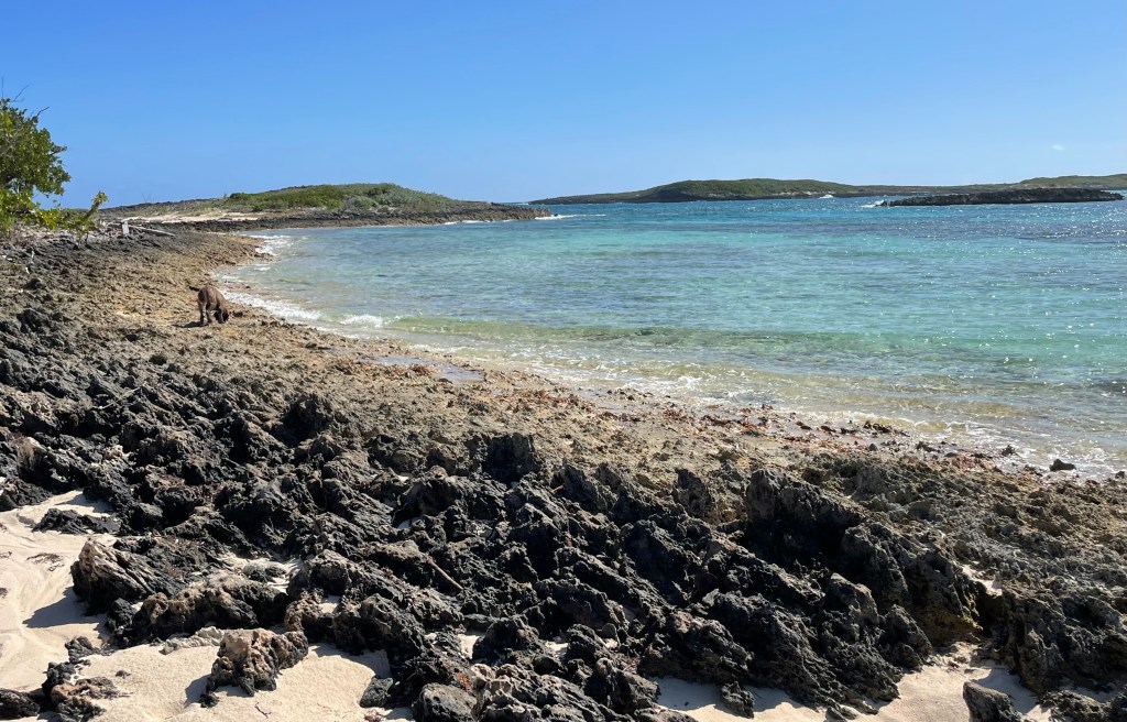
Hard to see the waves crashing over these rocky outcroppings.

On the way back to Hope Town, we passed a MASSIVE marina being totally rebuilt from the ground up (or water up). Pilings being driven, cement being poured. Dozens of laborers.


A little farther down the road, we pulled into the parking lot of the Abaco Inn, poised on an oceanfront bluff. I had a duck confit club sandwich (yes, you read that right) with a Kalik, one the local Bahamian beers. YUMMY.


From our little hightop table, on the top of the highest bluff on the island, we could see behind us all the way back across the Sea of Abaco to our resort. But the view in front of us was truly spectacular: huge swells coming in off the Atlantic, breaking all along the reefs that guard the beaches. And the beaches run off to the south as far as one can see.


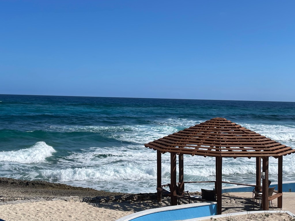
I have travelled extensively (Cape Cod, Australia, South Africa, New Zealand, Brazil) and I don’t recall a more spectacular oceanfront scene.

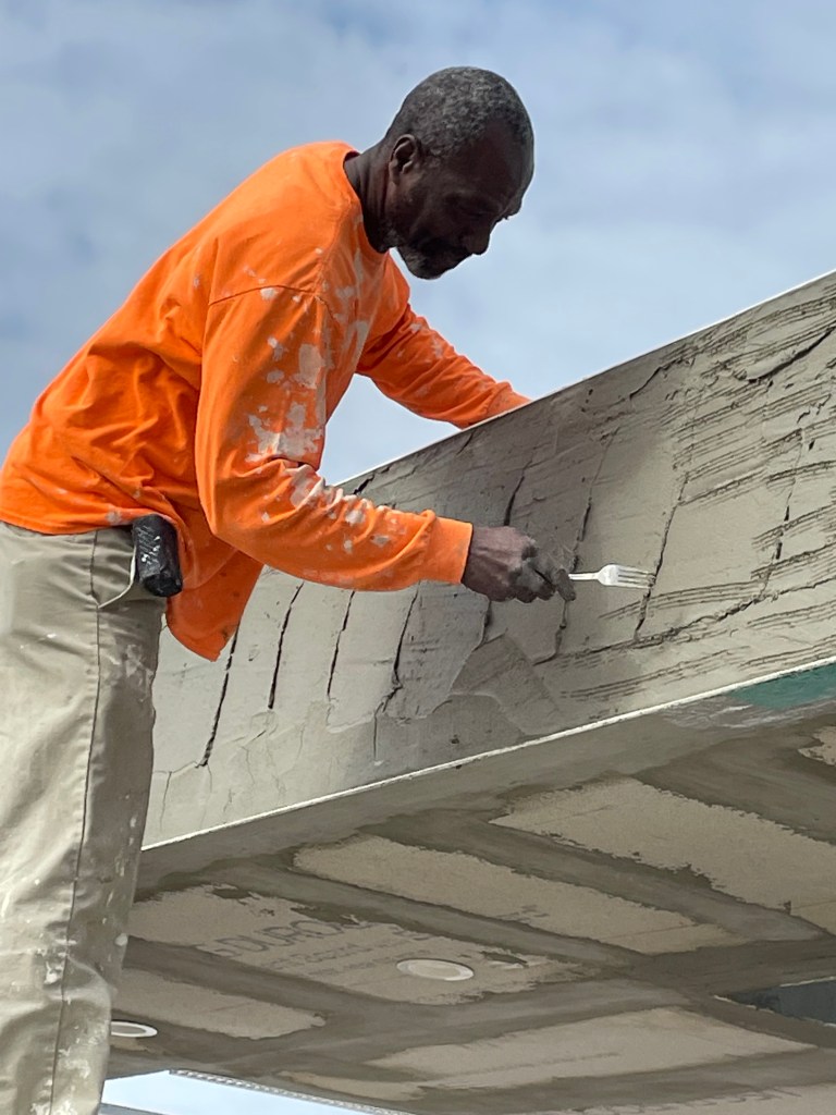
As you can imagine, rebuilding a nation take a LOT of skilled labor. This fellow is what’s called a “mortar forker”.

TTFN


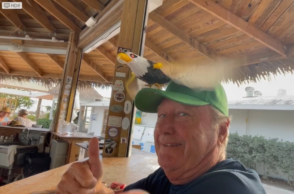
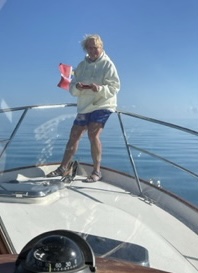
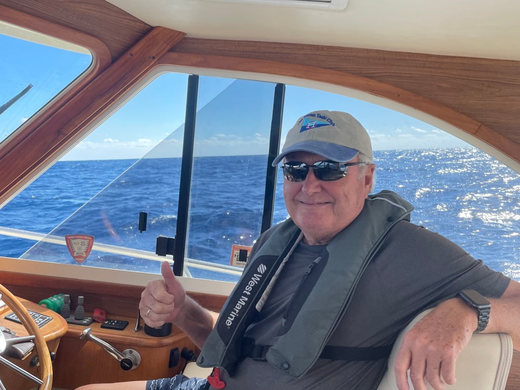
PS: Sunday was a great day for Eagles’ fans. Here’s Rod with his special hat, drinking “green” mojitos in 78 degree weather. GO BIRDS!


Rod’s Boat Beeps!

Lynn here today….

So, let me tell you about the beeping boat. The word “beep” as used here is an actual beep, not a substitute for a different four letter word. 

Sometimes beeps are good things. When we are underway and nearing a waypoint where we must change course, the plotter beeps so you acknowledge and approve the new direction. 

Beeps can also be a good thing if the batteries need to be recharged. If we’re not on shore power, Rod will occasionally run the generator to recharge them, allowing us to stay comfortable and be able to make coffee, use the hair dryer or curling iron, or cook dinner. 

And then there’s the fridge. I swear it’s haunted. We get an error code and we know there’s a sensor that needs to be replaced and the part is ordered and will be waiting for us in Florida. But this thing has been beeping for four days….and mostly just at night. The manual tells us how to stop it, and that seems to work pretty well during the day. But if we reset it at night, it only stops beeping for about ten minutes and then starts up again.


The “beeping” fridge – looks cute but it’s haunted!

And the craziest part of all this beeping is that Rod doesn’t hear any of it. Nothing, nada, not a single stinking beep. The beeps are just beyond his range of hearing. So while he is sleeping soundly, I am awake listening to the beeping fridge. I’ve had about six hours sleep in the last three days. Stay tuned. Things could get ugly. 

Signing off


Sleepless in the Bahamas

Not my first chicken!

January 26, 2023

Guinness here today….

So yesterday was a great day. Good food, lots of walking and visiting with boat neighbors, afternoon at the pool, and a wonderful bath on the dock. I smelled so good afterwards. 

Rod and Lynn decided to head over to Hope Town today which is on an island about a 30 minute ride from Marsh Harbour. . I heard there are wonderful beaches and some great restaurants. The plan was to stay overnight in the harbor and dinghy to the restaurant tonight and then tomorrow go to Tahiti Beach which looks like a lot of fun. Huge sand bar and beautiful white sand where you can walk for doggie miles out into the water. 

After picking up a mooring in the harbor, we took the dinghy into town and tied up. A few cute shops but the one restaurant that was highly recommended was a long walk from the dinghy dock. So we all set out in foot.

A beautiful beach with great surf to play in!

We also passed some beautiful homes and some that are in serious need of repair.


You know I don’t like to be on the leash and I’m usually pretty good at staying with Rod.  But those darn chickens are so beautiful – and noisy. 

You might remember the blog from Key West when I caught a rooster and he left his feathers all over the street. My second take down was in Green Turtle. The chicken appeared to be dead, but I really don’t think I killed it. However today was the best adventure yet. A great big rooster crossed my path and he was really fast. It took me about 15 minutes to finally bring him down.

Rod and Lynn didn’t know where I was but they could hear the chicken and I could hear them calling me so I knew they were close by. 

I finally caught the chicken and again, feathers everywhere. They release them and it turns out I really don’t hurt them. They lay down for a minute to make me think they’re dead, and they they quickly run off.  But the story doesn’t end here. 

After running through the growth on the island and onto the beach, I was covered with burrs and thistle needles. My face, legs and belly were a mess and these things really hurt. We got back to the boat and Rod and Lynn tried to clean them up, but it hurts their hands too. 

So we had to leave Hope Town and go back to Marsh Harbour when they will try to wash me off on the dock. They said they would use something called “conditioner”. I hope it doesn’t hurt too bad, but if these things won’t come out, I heard them say I’m going to a vet to get shaved. I would hate that but I know they want onto take care of me. 

So we got back, set up on the dock, and I got washed a lot with doggie shampoo and Rod’s hair “conditioner”. I feel a lot better, but there are probably a few thistles still stuck in my fur so I’m going to have to sleep in the shower the next few nights.

So stay tuned until the next chicken crosses my path – but I think I’m going to be on the leash a lot more now. 

I kind of wrecked the trip to Hope Town but Rod is going to save the day – we hear the pizza at the restaurant is really good!

WWFN

PS: Here I am chillin’ after a tough day. So glad to be on the boat with my buddies.


Marsh Harbor 2- Abaco Resort and Beach Club

January 23-25, 2023

Yesterday (Sunday), I developed a VERY painful ear ache. So today (Monday), I had to run over to the clinic for some treatment. Fortunately, by the time I got there, I no longer had any symptoms, and the doctor, who was very good, could find no sign of infection.

Our marina neighbor helping get Guinness back to the boat after Rod left for the clinic.

Meanwhile, Lynn got a mani/pedi.(Walked almost a mile to the salon but it was worth it. However, the island had no water, so it was a dry mani/pedi – but they did a great job!).

We were told not to expect much in Marsh Harbour, but we have found everything to our liking. The nail salon was great. The clinic was great. The restaurants are great. And the staff here is friendly and capable. We are very impressed by Marsh Harbour’s efforts to recover, and this resort in particular has been a home run.


TUESDAY
This was a relaxed day. We made a late start, lying in bed reading and messing around on the Internet (yes, it was working!)


Then a leisurely walk into town for lunch at Colors. Shrimp tacos – special prices on tacos and margueritas for Taco Tuesday.


We met a young family at Fatty’s next door, and the little girls got to show us the shells they had found.


On the way home, we stopped at the Conch Inn and Marina, which is being beautifully rebuilt. The owner, Michael Aubury, told us stories of living through Hurricane Dorian on his home island – Man’o’War Cay. Amazingly, no one was killed, or even injured. But all the buildings there were destroyed. As was The Conch Inn and Marina, which he owns, in Marsh Harbor. 250+mph winds. Unimaginable.

The Conch Inn is open for business and we will be trying the attached restaurant, Snappa’s, soon.

After we returned (after too many Margueritas) we fell back into bed for a nap, and then had a lovely afternoon just talking – sharing stories about our prior lives.


WEDNESDAY
Another relaxing day. (Are you seeing a pattern?). We did the laundry and some provision shopping, but we had plenty of time to relax around the pool and read. Hot dogs and beans for dinner. One of my faves!

TTFN

Abaco Resort and Marina

January 19, 2023

The JOURNEY is the adventure. We get that. But there are certain iconic stops along the way. One was certainly Key West. It is a DESTINATION.


We are at another one now: Marsh Harbor, the commercial center of The Abacos and site of the larger of two international airports.


The resort is lovely by any standard, with beautiful buildings, beautiful paths and plantings, great food, two pools, brand-new docks, and a gorgeous, resort-style beach. All rebuilt after Hurricane Dorian in 2019.

Wikipedia tells us all we need to know about Dorian: “Hurricane Dorian was an extremely powerful and catastrophic Category 5 Atlantic hurricane, which became the most intense tropical cyclone on record to strike the Bahamas, and tied for strongest landfall in the Atlantic basin. It is also regarded as the worst natural disaster in the Bahamas’ recorded history…Dorian struck the Abaco Islands on September 1 with maximum sustained winds of 185 mph (295 km/h), tying with the 1935 Labor Day hurricane for the highest wind speeds of an Atlantic hurricane ever recorded at landfall. Dorian went on to strike Grand Bahama at similar intensity, stalling just north of the territory with unrelenting winds for at least 24 hours. The resultant damage to these islands was catastrophic; most structures were flattened or swept to sea, and at least 70,000 people were left homeless.”


This is pretty typical of the homes left standing. Look behind it and you can see buildings on the left and right if the photo that are destroyed.

The town of Marsh Harbor still looks like a bomb hit it. The commercial buildings and marinas are still being rebuilt, but the smaller shops and homes are gone. I suspect it has to do with who had insurance and capital.


It’s an easy half-mile walk from our marina to the center of town and we walked in today to look around and have lunch. It was perfect: lunch on the dock at “Colors” – the best shrimp quesadilla EVER, and a lot of Kalik Llght, one of the local beers.


Next to the dock, we watched Tristan Ingram (Fatty to his friends) prepare conch salad from scratch.

VERY time-consuming. Removing the conch from a dozen of those heavy, spiral, pink-lipped shells.


Cleaning the conch, dicing onion, tomato, green pepper, habaneros, salt and lime. Kind of a ceviche. We took home a container, and I can’t wait to try it tonight. Here’s some photos of him making the salad.


Lynn is sitting in the shade of our awning, on her computer as usual, and commenting on how nice it is to be here for a month and not have to worry about wind and weather for our next passage.


Life is good.

GREEN TURTLE CAY 3 – JUST A DROP IN THE OCEAN

January 17, 2023

This morning, I have been planning our route from Green Turtle Cay to Marsh Harbor. As I’ve mentioned (at length, I know), sandbars block the route south through the Sea of Abaco, so all but the shallowest vessels have to pass into the Atlantic via Whale Cay Channel, go around Whale Cay, and then reenter the Sea of Abaco through Loggerhead Channel, passing just inside Great Guana Cay.


The routes are all marked on the charts; it’s just a matter of entering the Waypoints into the chart plotter, and then connecting them to build a route. It looks like the entire outbound and inbound passage will take less than an hour.


As I was (once again) looking at our position on the charts, it occurred to me that many of you might have trouble envisioning exactly where we are. Try this: Open Google Earth and search for Green Turtle Club. Drop a location pin on it, so that you can expand the map area without losing it. See screen shot above.


Expand the map a bit to include the islands just to the right of Green Turtle Cay. Now the landscape becomes clear, doesn’t it? You can actually see the sandbars that block our southbound passage. You can see the cays – Green Turtle, Whale and Great Guana, that we are talking about. These are three of the barrier islands or cays (pronounced “keys”) that separate the Atlantic Ocean from the Sea of Abaco. (above)


To the east of these cays – toward the open Atlantic, you can sense where the line of reefs lie. And beyond the reefs, you can see the change in water color where the ocean floor plunges into the abyss. (Marsh Harbour near the bottom is where we are headed next.)


Now expand the map to see the entire Bahamas chain. Green Turtle already seems small, doesn’t it?

Now back out still farther to include the coast of Florida and Cuba, and you begin to understand what I mean when I say it is “just a drop in the ocean.

GREEN TURTLE CAY 2 – IT’S ALL ABOUT THE WEATHER

January 15, 2023

As predicted, it started blowing Friday night, and it didn’t relent until this morning. 36 hours of gray skies, dark waves, and a cold, gale-force wind. There were even waves inside the harbor, and the boats were rocking. But everyone was tied securely, and there were no problems.


Today seems very different – we are returning to normal. The clouds are white, the sky is blue, and the sun is warming everything up. We had expected to leave today, but it’s now apparent that sea conditions will keep us here until Wednesday. Oh no! Three days by the pool. Or the beach. Drat.


For those of you who know Lynn, you know that she is an avid learner. If she’s involved in something, she wants to master it. Her new focus is weather forecasts, and I’m glad to have her involvement, because they often require interpretation and agreement on our indicated action. I’m happy to make these decisions on my own as Skipper, but I’m happier to do it with Lynn’s involvement.


We have a half-dozen weather apps on our phones, and we subscribe to two additional services that arrive by email each morning. We understand that ALL of them begin with the NOAA forecast, and then they fold in local data like reports from weather buoys.


Why do we look at so many? Because each differs slightly, and we are learning which ones prove to be more trustworthy and more intuitive to use.

Here’s one example of the Windy app with tons of data. The wind direction and speed are towards the top, and the wave direction and height ar towards the bottom along with the tides. The winds drop from 26 mph to just over 5 but the waves only drop from over 7 feet to around 5feet and stay for the next two days. On Wednesday they drop to 2 feet which is where we are comfortable. We can scroll ahead five days on this app.


While this tabular data is very helpful, one of the reasons that we enrolled in the Chris Parker subscription forecast is that it offers more locally-specific and Bessel specific info: He takes the meta forecast; “A cold front is approaching from the west”, and he explains the local effect: “This will produce a line of dangerous squalls across the Central Bahamas from Friday evening to Sunday morning.” He also offers more direct advice on what to do or not to do: “All vessels should plan to be in port by Friday afternoon.” OK, that’s clear enough!


So, while we have been pinned down by the wind, we’ve been studying the forecasts and talking to the other boaters here on the dock. And the consensus is clear: while the winds diminish today, Monday, and Tuesday, the seas don’t calm down until Wednesday. Prior to that, they are still running 4-5 feet. That wave activity, and the direction they are running, creates a “Rage” condition in the Whale Cay Channel.


We had come to that conclusion on our own, but it is reassuring to have other skippers voice the same opinion.


TTFN. We are off to the beach. Or pool!

Green Turtle Cay

January 13, 2023

Thank goodness for our subscription, personalized weather forecast…


We had a glorious trip from West End to Green Turtle Key on Wednesday. 100 miles of calm, crystalline water.
Here’s a shot of Lynn on the bow, looking down at the bottom 12 feet below us.


The weather forecast warned boaters to be safely in port by Friday afternoon, because we are in for rain at 4PM, followed by a two-day blow with gusts to 35mph. We were all tucked in by Thursday at 1PM.


As a consequence, we were able to rent a golf cart today and explore the island. There are two sounds: White Sound at the north end of the island, and Black Sound at the south. White Sound is all residences and resorts. Black Sound is locals and commerce. The commercial ferry, for instance, lands at Black Sound, and the landing wharf is all trucks and forklifts. All the food and produce, all the building materials, etc., all has to come in by ferry. That’s why everything is so expensive. I won’t even tell you what we paid for a case of soda and a case of beer…you would question our sanity.


Once we finished our tour and shopping, we spent the afternoon at the beach on the east side of the island – the Atlantic side. As we drove around the island this morning, we could see the Southeast wind stirring up the waves on the west side of the island – Abaco Sound.


But at the beach, the water was calm, and we enjoyed the sun and the gentle surf. Guinness had a ball.


We had the mile-long beach entirely to ourselves! Heaven.

The hood is up to keep from getting sunburned ears – the weather was perfect.

Now, we’re back at the boat. We had a passing shower at 4PM, followed by a perfect rainbow.


I expected the Green Turtle Club to be rather chi-chi, but I am starting to realize that things need to be measured by Bahama out-island standards. The staff is nice; the marina is well maintained; the food is quite good; but the buildings themselves are unpretentious. This place has been a favorite for visiting yachtsmen since 1964, and the walls and ceiling of the bar are covered with dollar bills and burgees left as mementos.


For the next leg of our trip, we have to transit a pair of “Cuts” between islands: Whale Cay Channel and Loggerhead Channel. They are EZ-PZ in fair weather, but they are susceptible to what the locals call a “Rage” when the wind and current disagree. We know there are two days of strong winds coming up, so we’ll have to wait until Monday or even Tuesday to leave for Marsh Harbor.


Hopefully, we’ll get to spend some of that time on the Eastern beaches, sheltered from the wind in the lee of the island.

Old Bahama Bay

January 11, 2023

This place is a big surprise. It is a resort and marina on the northwestern tip of Grand Bahama Island, and a popular landing spot for boaters traveling from the East Coast of the US. You can clear Customs and Immigration here.


In general, there are two destinations for Bahamas-bound boaters: Bimini (called the Southern Route) and West End (the Northern Route).


It’s a gas: when you first arrive, you have to fly a yellow “Quarantine” flag, and only the captain can go ashore to clear Immigration and Customs. You buy a 60-day Cruising Permit. Then you go back to the boat, cut down the “Quarantine” flag, and hoist a Bahamian courtesy flag. Old Glory still flies on the highest flagpole.


When we planned on stopping here, I didn’t expect too much. I thought it would be small, and kind of run-down. Lynn checked it out in advance on TripAdvisor and learned that there is just one restaurant on the property. For anything else, TripAdvisor directs you to Nassau. YUK!


As it turns out, this is almost heaven. It is a sliver of land with the Straits of Florida on one side, and the Great Bahama Bank on the other. Which means you have panoramic views of both the sunrise and the sunset.

Sunrise


It also has: buildings painted in Bahamian shades of salmon, rose, azure and yellow; free gas grills on the beach; a two-level swimming pool; beach hammocks; miles of white sandy beaches; and walking trails out to rocky crags. Simple and unpretentious.


And they are dog friendly! I can’t tell you what a joy it is to let Guinness run free on the beach. He wore himself out swimming and running.

Guinness trying to decide whether to go after the heron on the left like he went after the chickens in Key West


I am so glad we stayed an extra day, instead of thinking that we had to press on to our next destination. We have found the Bahamas, and they are here.


Nevertheless, we leave tomorrow for Green Turtle Cay and the Green Turtle Club, which I imagine will be much more chi-chi. Somehow we will manage.

Today would have been a perfect travel day – light winds and no waves to speak of. I am taking a chance by waiting until tomorrow. But the forecast is still good (if not as good as today), and I really wanted a rest day after our crossing from Florida.


The chart plotter is telling us that it’s a 7-hour trip tomorrow…100 miles. Certainly the longest leg so far. If we leave at 7AM, however, we’ll be in by 2PM. And – unlike the Gulf Stream crossing – we’ll be in sight of land all the way. One little island after another. Initially, we head east for 50 miles across the Great Bahama Bank. Then a turn to the right for another 50 miles on a southeast course. This will take us into the heart of the Abacos.

I just hope the waves are calm. That’s all I ask. There is a front coming in that is going to make it cold and VERY windy on Saturday and Sunday. Kind of like Christmas in Key West. So it will be good to be snug and safe at Green Turtle Cay!

Sunset

Anyway, we are off to see the sunset.

Bahamas!

January 10, 2023

Today’s crossing went exactly as planned. Maybe better.


It was a 5-hour trip: an hour out to the Gulf Stream, and then 4 hours ENE to West End on Grand Bahama Island.


Based on the advice of our subscription weather service, we didn’t leave the Ft. Lauderdale inlet until 11AM, and we arrived exactly at 4PM.


The wind and waves diminished steadily as the afternoon progressed, and by the time we cleared Immigration and tied up, the sea was like glass!


I’m going to keep this post short. I just wanted you all to know that we are safe and sound.

TTFN