Key Largo

We left later than usual this morning – on purpose. They wind prediction app we use (Windy.com) indicated that the winds would diminish as the day went on, and that’s what happened. We started out at 9AM under Small Craft Warning, and ended up with a very pleasant ride. In addition, since the wind was out of the north, it put Hawk Channel in the lee of the keys all the way down. Good planning and good luck!

I used the extra time this morning to clean the water strainers, add some coolant, and add some oil. The engine ran 3 degrees cooler. Nice.

By the time we got to Key Largo, the seas were fairly smooth, and the water color had changed dramatically. It’s now an aqua blue, and very clear.

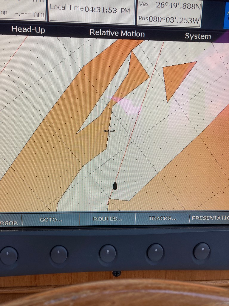
The chart plotter is still not working as it should. I bought a new ScanDisc card, but the chart plotter is not recognizing it. So I downloaded a marine chart app (AquaMap), and I am using that on my phone for when I need detailed visuals. (Thanks, Art, for the suggestion.)

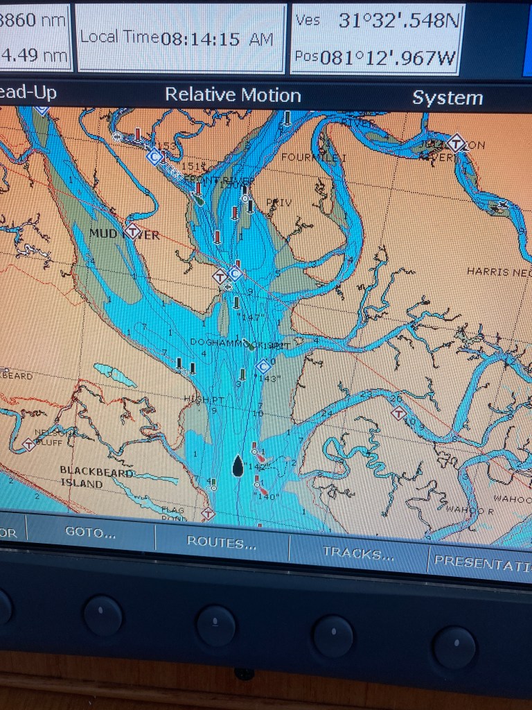
I can, however, use the chart plotter for creating a route and covering long distances. Here’s the way it looked today:

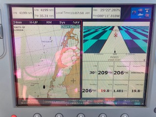
It’s a split screen, showing the route on the left. The red line is the route I created, and you can see the cursor following the route. The view is set for 24 miles. It looks like we are headed north, but this is called a Heads-Up presentation. It’s the way the captain actually sees the path ahead. It’s the same thing the GPS in your car does. I am looking ahead, with the Keys on my starboard side, and this view mimics that. It’s a lot less confusing.

The screen on the right is called the Cross-Track Error, or XTE. It ensures that the autopilot is pointing exactly at the next waypoint. As each waypoint is reached, the next one becomes the target. As you can see, I am 1.48 miles from the next waypoint.

*********************

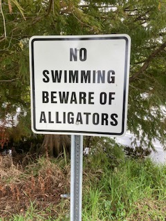
So, here we are – safe and dry in Key Largo, and I love this place. To get into this marina, you have to travel a mile-long canal that is barely two boats wide. And not very deep in spots..

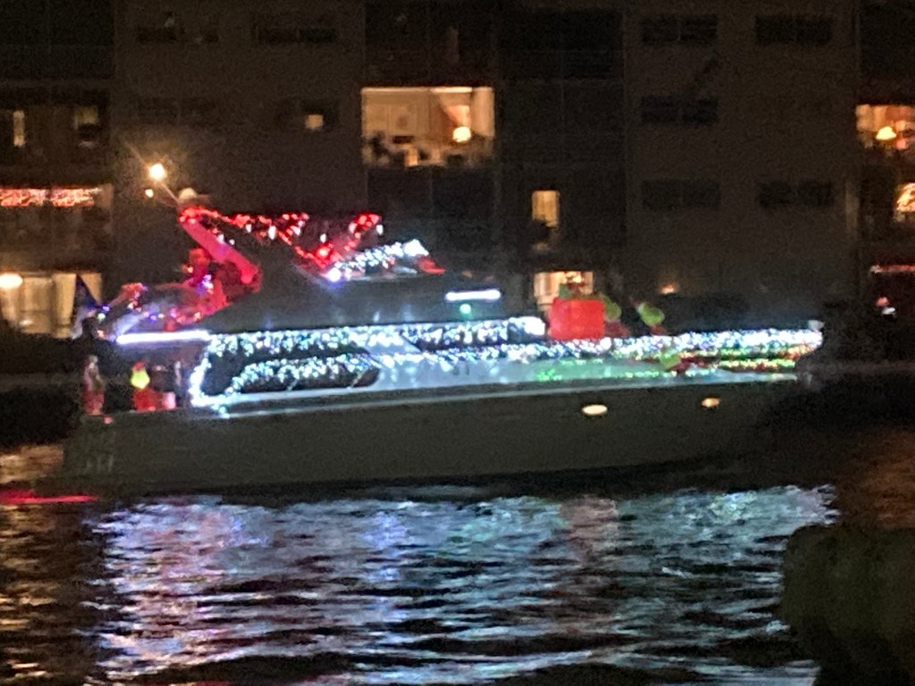
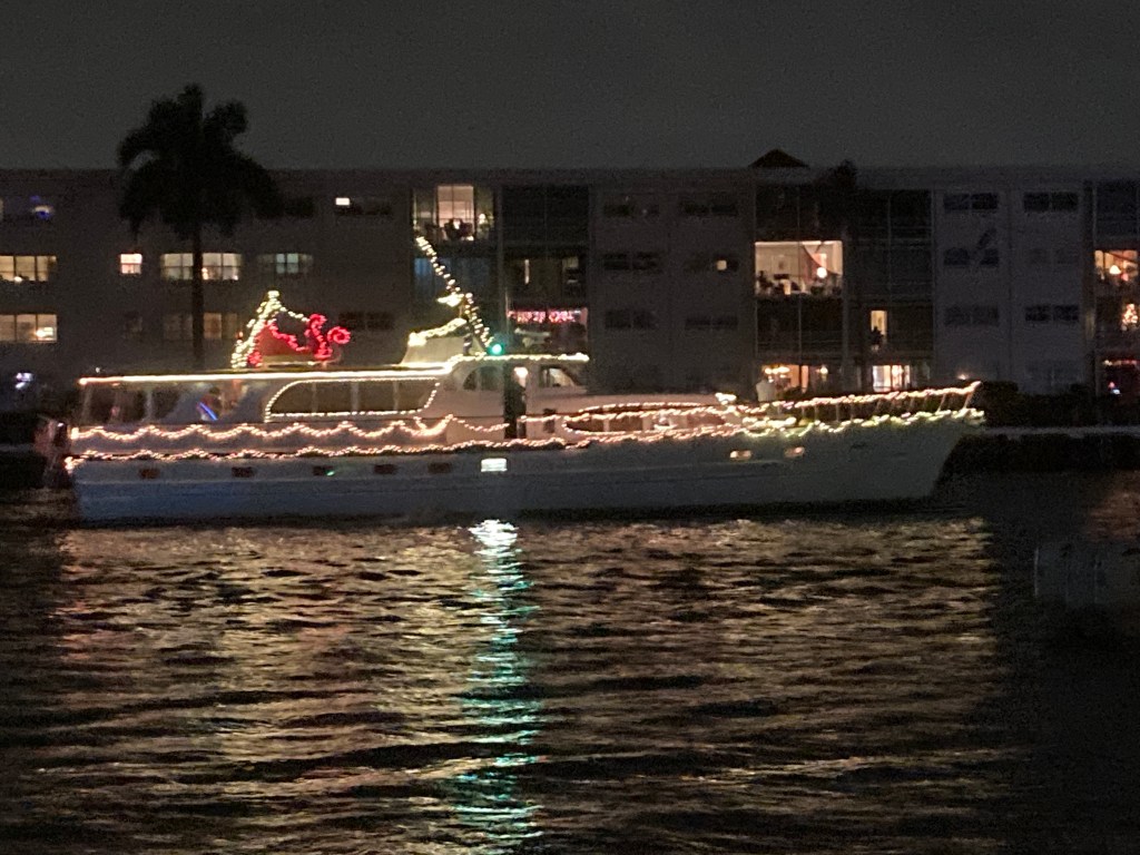
But I love it now that we’re here. It has a laid-back style, but the docks are first-class, there are three restaurants nearby, and they have me docked between a 55′ Prestige and a 65′ Cranchi. Of course, they can’t compare with the 250′ mega-yachts at Bahia Mar, but they’re not too shabby!

Just finished washing the boat. I have to wash it every day; it gets absolutely coated with salt.

But now I gotta go. The sun is getting low in the sky, and this blogging is cutting into my drinking time.

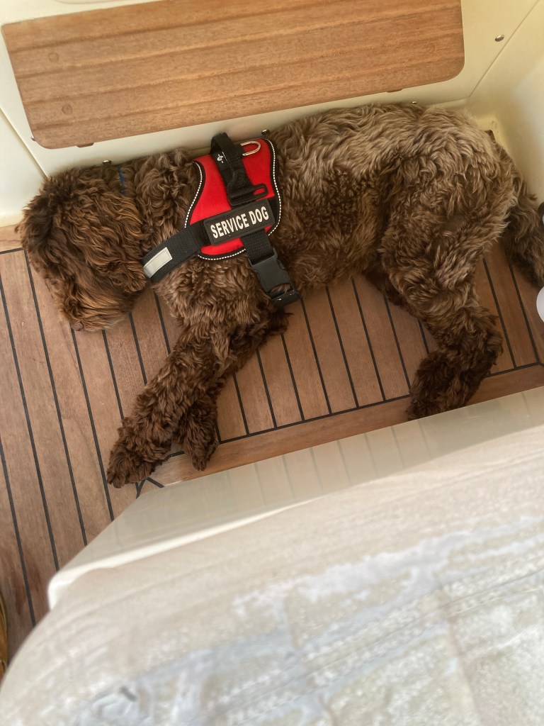
Adios from me and Guinness.

Palm Beach

I’m not crazy about Bahia Mar. Very expensive, and not much here in terms of amenities. Not even a decent restaurant onsite.

Brian and Lexi and I enjoyed a very nice evening, however: we ordered lobster rolls and fish tacos from an excellent restaurant, and we ate on board. Very nice. Very special.

Lexi asked me what my favorite part of the trip has been, and it made me realize that it has been the chance to connect with my family.

Anyway, today was very busy, and somewhat frustrating. Lots of running around (Uber) and re-provisioning before the final section of the trip. The chart plotter is still not fixed, but I expect the part I need to be delivered around 4PM.

In the meantime, I have created a route from here to Key Largo. I took an Uber to West Marine and bought a thumb drive to update the chartplotter, so all is well.

Key Largo coming up! Humphrey Bogart/ Lauren Bacall anyone?

Rather than going through Biscayne Bay (the Inside Route), we’ll be taking the Outside Route (called Hawk’s Passage). I’m a little apprehensive, because it’s open ocean, and once you commit, it’s difficult to change your mind.

Still, I can’t wait…we’re going out the Palm Beach (Fort Worth) Inlet, sweep completely past Miami, and run down the keys to Key Largo. We’ll be just a mile or less offshore, running between the Keys on our right and the reefs on our left.

Then Marathon Key. Then Key west. So close.

Gotta run. Time to try and fix the chart plotter.

Boat Parade

I thought you might get a kick out of these photos of the North Palm Beach Christmas Boat Parade. More than 40 boats, each decorated more extravagently than the one before it. Hundreds of lights on each boat…maybe thousands? Really fun for me, but Guinness was freaked out by the fireworks display that kicked off the parade. plus, the best “Corona” Christmas trees ever…palm trees decorated right up into the tips of the fronds.

An Exciting Day

  1. My chart plotter quit.
  2. Got busted for going too fast in a Manatee Zone.
  3. Left the ICW- went Outside from Vero Beach to Palm Beach.

They are all related…read on.

INCIDENT #1:

Five miles south of Vero Beach, my chart plotter quit. Here’s what it’s supposed to look like:

It’s almost like a video game: the black cursor at the bottom is Freedom, and my job is to follow the line between the buoys, which come at you pretty fast. I am so grateful that someone – sometime in the past – plotted the only deepwater path and marked it with these buoys and channel markers. Then the makers of the electronic charts added the line marked right down the center. It actually appears as magenta. Boaters simply refer to it as the Magenta Line!

Contrast that with the photo below. Here’s how my chart plotter looks now: the landmasses are just crude geometric shapes, water depths are not shown, and neither are the channels!

So what do you do?

You go back to basics. You follow your paper charts, and you look ahead for the corresponding red and green markers. Essentially, you are flying by Visual Flight Rules (VFR) rather than instruments. All the kids in my family grew up this way. Chartplotters hadn’t been invented, and we never even had paper charts. We were just kids, racing from buoy to buoy. Time to do that again.

INCIDENT #2:

Because I was glancing back and forth between the paper charts and the actual image in front of me, I missed a SLOW sign for Manatees. In these waters, the speed limit can drop and then revert with a 1/4 mile. I had been so careful, reading the signs with binoculars to ensure I complied. Not just for the law. For the Manatees. Fortunately, I only got a warning instead of a $250 fine.

INCIDENT #3:

Here’s the cool part: I had always planned to go outside once I reached south Florida. This whole area was reported as being very confusing and very congested. Once I saw the weather forecast, I knew we’d go outside today.

So after picking my way along under VFR for about an hour, I exited the ICW at Ft Pierce.

It was gorgeous. Warm sunshine, calm seas. And no channel markers! We ran along the coast for about 3-1/2 hours. Heaven. If it had been the New Jersey coast, you could have seen Lucy the Elephant.

We came back in at Palm Beach (Ft. Worth Inlet), and it was immediately apparent that we’d done the right thing. It was INSANELY busy. Gigantic cruise ship, mega yachts, throttle jockeys in center consoles, and PWC’s (jet skis) all competing for space in a narrow channel. And people just one boat-length to my right lying on a beach under umbrellas.

Once again, some bad luck and some good luck, and the good luck won!

Now we’re safe and dry at Old Port Cove Marina, and the Christmas Boat Parade is tonight. (I hope to send some photos tomorrow.) And the restaurant has New England Lobster Rolls!

Tomorrow we leave for Ft. Lauderdale. I’m staying at the Bahia Mar Marina (home of the famous and fictional detective Travis McGhee). I plan to stay an extra day. I’ll try to get the Chartplotter fixed, and I need a rest day. Also, my nephew Brian is coming to Ft Lauderdale instead of Palm Beach so that I can meet his girlfriend Lexi. And there’s a gorgeous beach for Guinness. Super.

Vero Beach

We pulled out of Titusville at sunrise: 7AM on the nose.

As you see in the photo, the waterway was dead calm, with some lingering sea smoke, and we made great time; we were safely tied up in Vero Beach by 11:30.

A pelican was my wingman on the trip this morning. Flying the same speed as Freedom (20 knots), he would flap is wings a few times to gain a few feet of altitude, and then he would glide along, very close to the surface, for about 100 feet. The tips of his wings slant downward at the very end (like some modern aircraft), and he was so close to the water that his wingtips nearly touched the water.

Our plan of starting early and getting to the next destination by early afternoon is working well. First, we get two hours of WOT travel in before the slugs get moving. Then, we have time to see the next town.

And, by the way, I LOVE Vero Beach. We walked over to a huge dog park before lunch. Then lunch at the Riverside Cafe, at a riverside table, of course. Fish Taco…yum!

I enjoyed the local wildlife in a waterside park. The pelicans are beautiful up-close, and I love the Ibis, with their beautiful curved beaks.

Guinness tried to swim in some of the lagoons and ponds in the park, but Uh-Oh!

I figured if he wanted to swim, we had better get a look at the Beach part of Vero Beach, so we took the FREE bus from the marina to the beach (ocean), and once again Guiness had a ball chasing sea birds for half an hour. On the way home we got to see the town itself…very cute, very upscale.

Still, it IS Florida after all, so we also got to see this really cool mailbox: a real vintage Evinrude (missing its guts). Absolutely excellent!

Tomorrow we’re off to Palm Beach. We are staying at Safe Harbor Old Port Cove if you want to Google it. It sounds lovely. I’ll get to have dinner with my nephew Brain. A very cool young man.

Palm Beach is at Mile Marker 1015. And remember, Key West is 1250. Really getting close now, and Vero Beach really looks like Florida!

Titusville FL

A pleasant, uneventful trip today. At 70 degrees, it definitely feels more like Florida.

We saw another manatee today, and a handful of dolphins. Just glances…no close looks.

Frankly, the big news today is not my trip, but rather Covid-19. As I type this, I am listening to a VERY sobering report from NPR about the recent surge and the huge logistical challenges associated with distributing the vaccine. Considering that this is happening in the midst of a political transition, and given Trump’s horrible history of poor transitions, I am not sanguine.

Tomorrow, we head for Vero Beach. So many snow birds choose to stay here, that it is called Velcro Beach.

We are fine, but that’s enough for today. Love to you all…stay safe.

Daytona Beach

We made it to Daytona Beach by noon. 80 miles. It seems early in the day to knock off, but that was 5 hours of fierce attention to the chart plotter. That’s enough.

Here’s an interesting note…we were blasting along at 20 knots through a very pretty narrow passage in Palm Coast, when I spotted a couple in a racing shell off to the side. I immediately slowed to idle speed, so that I wouldn’t swamp them, and it’s a good thing I did. A manatee surfaced several boat lengths in front of me, took a breath and dived. So cute.

Overall, it all went well. No drama (except for the Manatee). Certainly no trauma. It was a fast leg. Also, I am happy to report that the boat runs better with the replacement prop than it did with the original! Yowza!

It’s about 20 degrees warmer here – in the 50’s instead of the 30’s. Tomorrow is expected to be another 20 degrees warmer. Maybe it will finally seem like Florida.

Today we did some critical re-provisioning: I was down to my last cigar! I bought about 20. And we got some meal toppers for Guinness. 20 of them too.
Thank heavens for Uber!

Tomorrow will be a short run – just 50 miles to Titusville. I wanted to go farther, but several marinas are now closed to transients due to Covid. I am going to have to pick my way along from marina to marina, and maybe anchor out a few nights. Which is OK except for taking Guinness ashore. Hmmm.

Jacksonville Beach

We awoke in Brunswick at 5:30 this morning to a jet back sky and a brilliantly clear full moon.  This will, of course, affect the tides.  There is a variance of more than 7 feet in this area between high and low tides, so I’m glad we’re leaving on the high.

The real surprise was the temperature.  32 Degrees!  Yikes!  I thought I would not see that until our return in the spring.  Had to get out the leather jacket and gloves, which I had relegated to the rear of the hanging locker. Plus a gorgeous cashmere scarf ( a gift from my niece Amanda).

Now we are in Jacksonville Beach. It is 2:30 in the afternoon, and it is STILL cold: 36 degrees! I brought a small space heater with me (a suggestion from my Yacht Club friend Art Nielsen, who has made this trip several times). Today is the first day I needed it. (The onboard heat only works when we’re plugged into shore power).

It was kind of a rough trip. The wind has been blowing from the west for several days, and the ICW requires you to cross a series of Sounds. A Sound is like a broad river that opens directly into the Atlantic Ocean. These Sounds run east to west, so the wind has a long “fetch” – a long distance to build up waves. The seas were confused and sloppy.

The coolest sight was sea smoke. Because the air is colder than the water, there was a wispy fog just above the surface of the waves. Very pretty.

The worst problem was the sun glare. Because the sun is so low in the sky this time of year, it was constantly in my eyes. Sunglasses cut the glare, but then you can’t read your instruments.

But anyway, we made it. This is a sizable marina: 350 slips, with a good restaurant. And the waitress in the restaurant is cute. Young enough to be my granddaughter.

Tomorrow we expect to be at The Daytona Marina. It is 20 degrees warmer there today, and should be even warmer tomorrow. We are refueled and ready to go.